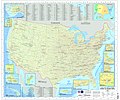
File:U.S. Military Installations Map.jpg
Appearance

Size of this preview: 717 × 600 pixels. Other resolutions: 287 × 240 pixels | 574 × 480 pixels | 918 × 768 pixels | 1,224 × 1,024 pixels | 2,449 × 2,048 pixels | 16,500 × 13,800 pixels.
Original file (16,500 × 13,800 pixels, file size: 52.36 MB, MIME type: image/jpeg)
File history
Click on a date/time to view the file as it appeared at that time.
| Date/Time | Thumbnail | Dimensions | User | Comment | |
|---|---|---|---|---|---|
| current | 15:51, 30 June 2009 |  | 16,500 × 13,800 (52.36 MB) | Sv1xv | {{Information |Description={{en|1=U.S. Military Installations Map (CONUS). This is a map of the major U.S. military installations in the continental United States. It is used by military and government contacts to assist in Federal communication to state |
File usage
The following 2 pages use this file:
Global file usage
The following other wikis use this file:
- Usage on en.wikiquote.org
- Usage on fa.wikipedia.org
- Usage on fr.wikipedia.org
- Usage on uk.wikipedia.org
- Usage on zh.wikipedia.org

